Project Description:
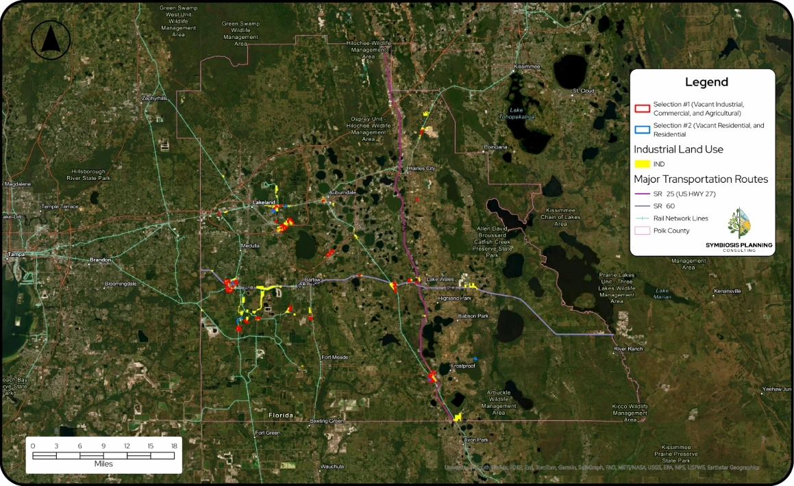
Our firm completed a comprehensive GIS-based analysis to identify parcels suitable for potential industrial development within Polk County, Florida. The objective of the study was to evaluate a large dataset of parcels and systematically narrow the results to identify properties that meet key criteria for industrial site selection, including land use characteristics, parcel size, and development readiness.
The analysis utilized the most current Polk County Division of Revenue parcel dataset (2025) and Polk County’s Future Land Use Map GIS Layers, consisting of approximately 426,311 parcels. Through a multi-step filtering process, parcels were evaluated based on industrial land use characteristics, acreage thresholds, and vacancy or underutilization.
Initial filtering identified parcels with predominantly industrial land use or a significant industrial component, which were then refined to focus on parcels ranging from 10 to 100 acres. While the original target range was 15–100 acres, the lower threshold was expanded to 10 acres to ensure that viable opportunities were not excluded.
The dataset was further analyzed to identify parcels that are vacant or underutilized, representing the most realistic near-term development opportunities. This resulted in two targeted search sets:
Project Specifications:
Search Set Results:
Services Provided